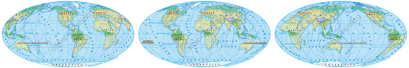
World maps can be generated in 3 variants of the central meridian, i.e. for an American, the continent of both Americas will be in the center of the map; a Vietnamese citizen can choose a map with Asia, Australia and Oceania in the center; an African and a European can also see their continent in the center.
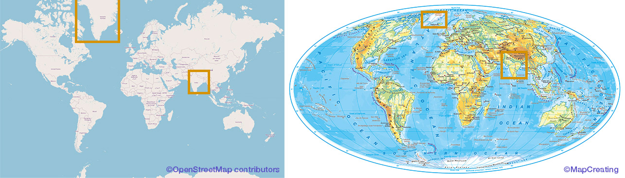
The geographic projection is always adjusted to the selected region on Earth. In popular online portals, authors use a single projection, not paying attention to the fact that they distort many areas, an example of which is Greenland, which is 5 times larger than India. In MapCreating, we make sure that regions are shown proportionally.
We provide maps not only for the continents, but also for the oceans. That is, there are also maps focusing on nations living in the middle of the oceans, usually not included on maps of continents or countries or microscopically shown on a world map.
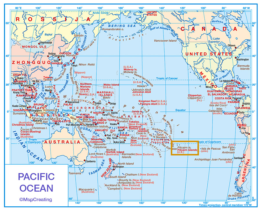
Examples of maps in the gallery, also free maps, are from all over the world, not only from the U.S.A. or Europe. In this way, we emphasize that all regions are equally important.
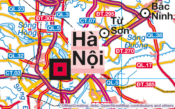
In the samples of maps in the gallery, for the names of towns or regions, we always add the name of the country, even if they are locations as well-known to everyone as New York.
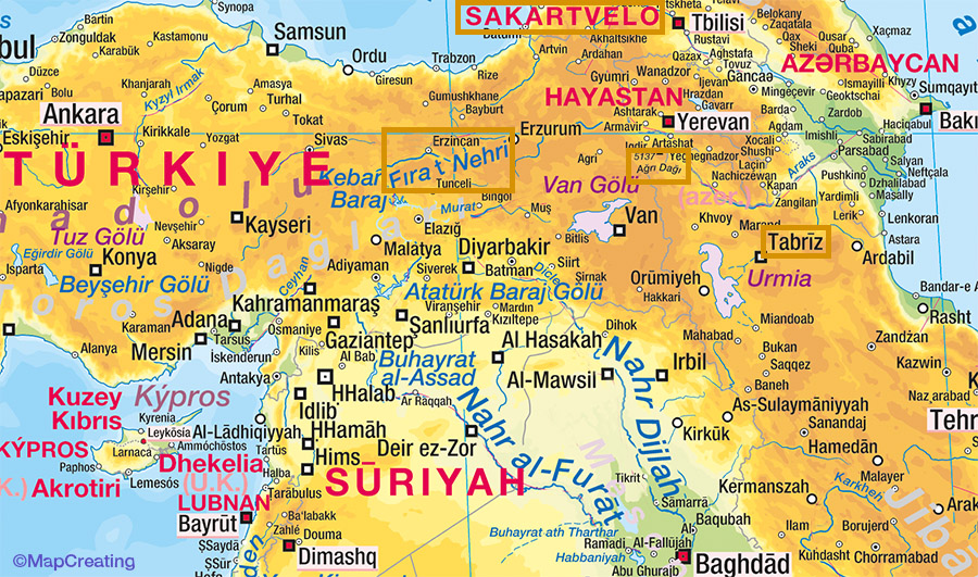
In the process, we promote names that respect national identity, e.g. the name of China is in Chinese, i.e. Zhongguo, and not in English – China; the name of Egypt is Miṣsr; Georgia is Sakartvelo. These are so-called endonyms, we use them for all names, i.e. streets, towns, rivers, peaks, etc.
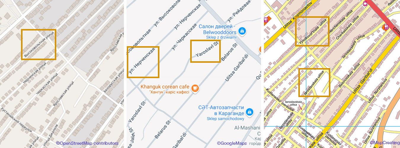
The names are in Latin transliteration/ Romanized, to be accessible to those who do not know other alphabets. Often, you can find the names written in the original alphabet only, readable only by the inhabitants of this country and hardly anyone else. Sometimes, there are names in the original alphabet and Latin transliteration, but for larger objects only. In our case, transliteration is complete.
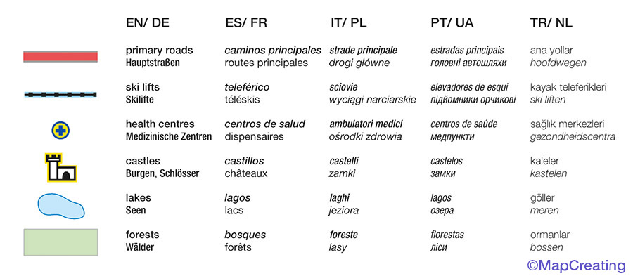
There is a legend in 4 of the 10 main Latin and Cyrillic languages, instead of English only. The signatures can therefore be described in, among others, Turkish, Dutch, Ukrainian, etc.
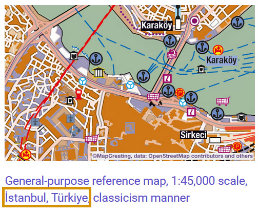
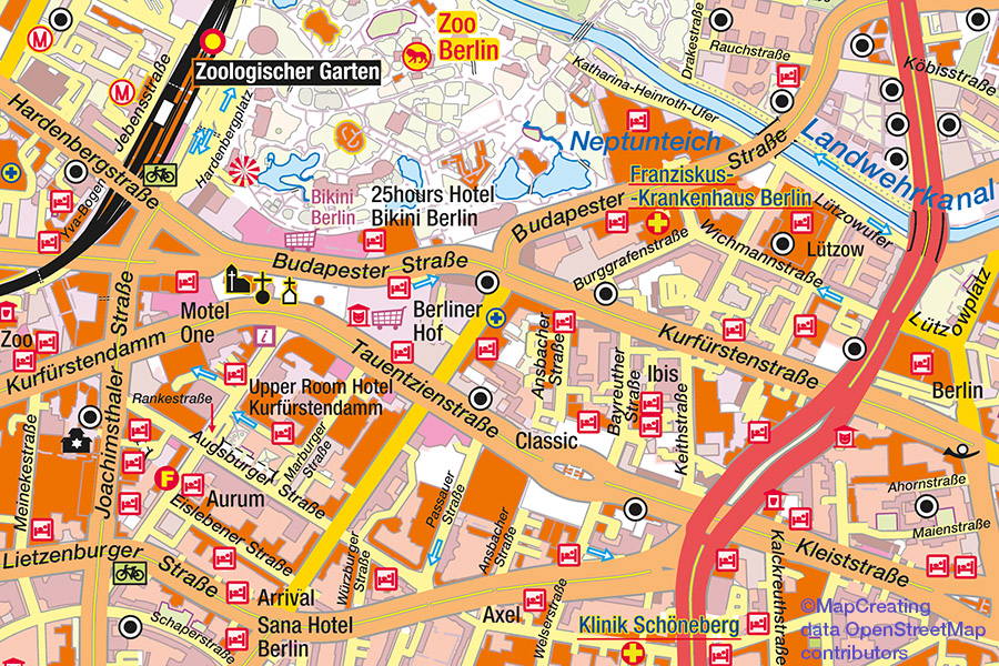
As part of the graphics styling, the user can choose one of the national manners. It takes into account the features characteristic of the several decades of cartographic tradition of a given country, e.g. a specific color for roads or buildings, the shape of the object symbol – POI, the color for descriptions of monuments, etc. In the era of scalable map portals, made available in uniform graphics for everyone in the world, we would like to remind you of the diversity that characterized maps published in different countries not so long ago.
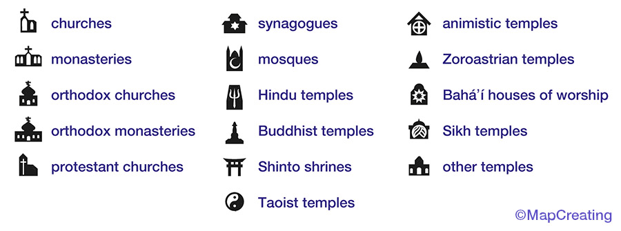
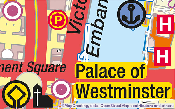
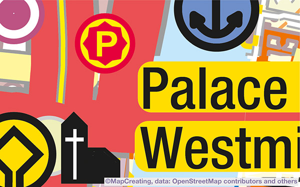
We show temple symbols depending on the denomination – about 15, e.g. on the map of Mumbai there are 8 different temple symbols. In this way, we try to respect religious identity, but not by generalizing the term as a temple or place of worship, but by indicating a specific denomination – if possible.
Visually impaired people can choose specially adapted maps, in so-called contrast manner. They have not only intense colors, but also enlarged signatures and wider lines.
If you want to use maps in different conditions, read from a greater distance, you can choose a graphic style in 1 of 4 symbol size ranges. Symbols can be enlarged up to 5 times.
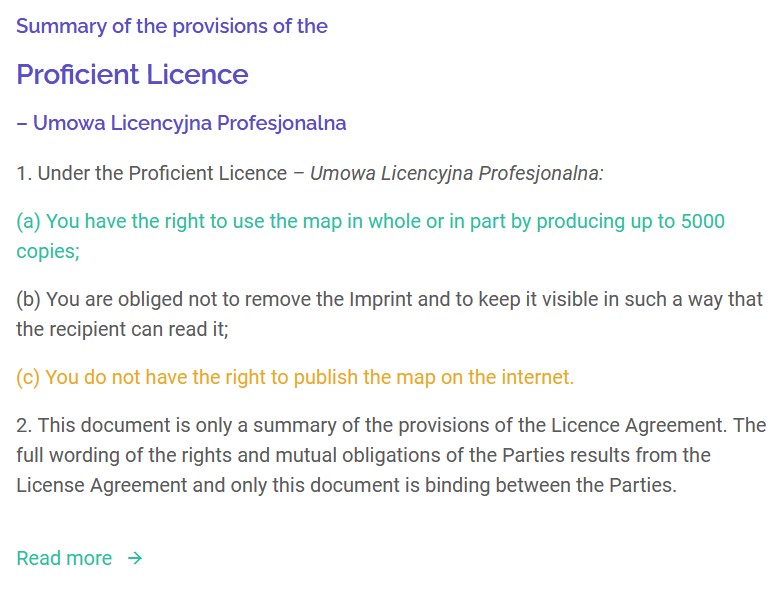
Legal texts of the licence have an additional, simplified form, human readable, because not everyone understands legal texts; but some issues are important and should be presented in an accessible way.
Map prices are adjusted to everyone’s capabilities, depending on the region of the world in which they live and from which they usually generate maps. We don’t want less affluent people to have to pay the same for maps – which often contain less information, than wealthier people – who usually generate maps from more densely edited areas.