In the gallery of Free Sample Maps we have made available to all interested parties a general-purpose reference map of Tonga on a scale of 1:4,000,000. The map covers the entire country – an archipelago, which is part of Polynesia.
The map is A4- sized, so it can be printed on a standard A4 sheet of paper without reducing it. The format is a raster pdf with a resolution of 300 dpi, which is excellent for showing on the web. The map was published under a free licence.
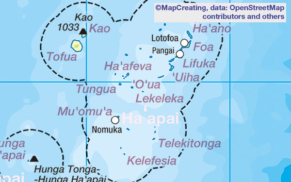
The content is current as of 2024. The most visible element is the bathymetry with the dominant Tonga Trench. There are many names of islands and towns, you can see the administrative names of island divisions. In principle, for a medium scale and geographical region, the map can be considered complete.
As you can see on the map, the Tonga archipelago is a series of islands, of two geological origins: some are volcanic and the rest are coral atolls. The highest volcano is Kao 1033 m a.s.l., in the center of the archipelago we can see the underwater volcano Hunga Tonga-Hunga Ha’apai, which last erupted in 2022. An interesting fact is the Minerva reefs, over which Tonga is in a small dispute with Fiji. Studying such a map can greatly expand our knowledge of the country.