In the gallery of Free sample maps, we have provided an overview map of Africa at a scale of 1:50m for anyone interested. It is an impressive case of using content PDF layers to be turned on or off in Adobe Acrobat Reader®.
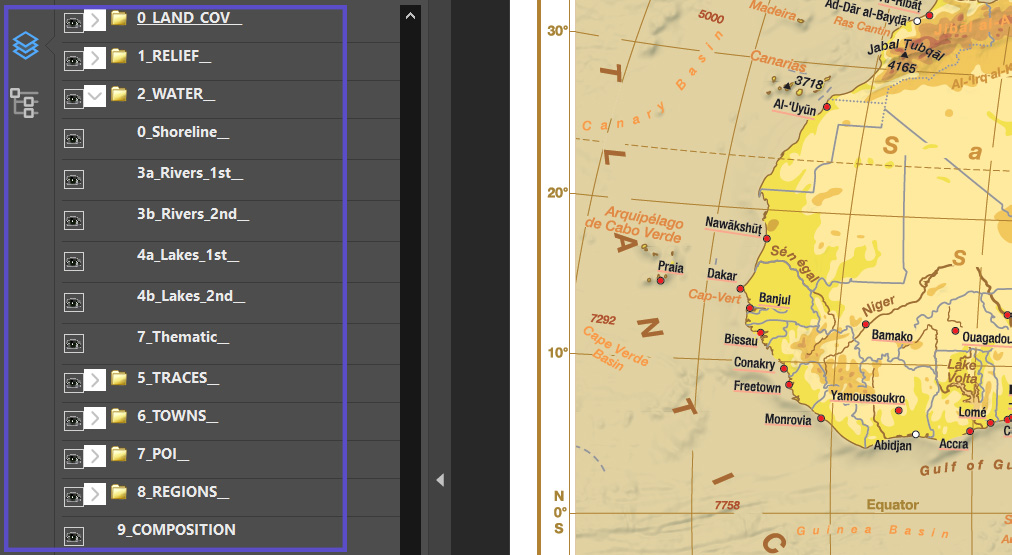
If you switch off the visibility of background data (group 0_LAND_COV at the top of the stack) or 3 layers with the names of the mountains and lowlands (down of the stack, e.g. 4a_Regions_1st),
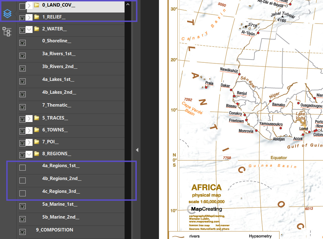
then you will get a map without dominant physical elements on land. You can make such modifications continuously, depending on our needs.
The map shows a discreet political division, state capitals and terrain shown in hypsometric colors, naturally adapted to the hot manner, like the entire content. Pay attention please to the names, they are original Latin, so-called exonyms, only maritime names are in English.
The map fits on an A4 sheet, it is legible, although it contains a lot of information. In Adobe Acrobat Reader® you can add your own content and publish the whole thing online, on an electronic board or insert it into a report or textbook.
As you can see on the map, Africa has an exceptionally undiversified coastline, with few bays and peninsulas. Hypsometric colors emphasize the mountainous nature of the east and south of the continent, while the west and most of the north are more even. The countries are mostly large, with straight borders – a remnant of colonial times. Apart from the capitals, we will find only a few larger cities on the map. Physical elements dominate at this scale, the river network, several large lakes with Victoria Lake at the forefront are worth noting. In the Indian Ocean, you can see many islands forming several maritime states. Studying such a map can greatly expand our knowledge of the continent in a few minutes.