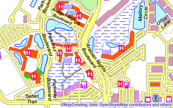
It was generated automatically in the MapCreating process, using vivid color brightness. This is a set of colors specially modified for viewing on monitors. RGB colors are vivid, but not aggressive or “burned out”. The ones that stand out the most are navy blues and purples. The map has been slightly modified by the cartographer editor.
Despite the very rich content, the map is still legible. In the foreground, we see a network of motorways and access roads to recreational complexes. Excellently presented, rich in symbols attractions and recreational infrastructure. All names of streets and lakes are legible, as well as bus stations and tourist train stations. On the frame there is described the geographical grid, there is also a rich 4-language legend.
You can see on the map, that the area looks incredibly attractive. It is not one, compact resort, but a set of recreational complexes. In the middle of each one you can see a lake, although above the largest ones, in the north-east, there are only ordinary residential houses. The huge parking lots around the complexes and various forms of access, such as cable cars, surface railways, trams and probably buses, are striking. And also a passenger line on one of the lakes. The number of attractions is overwhelming, you can’t get bored here even for a week. Studying such a map can greatly expand our knowledge of the resort.